Stage 5: Montcortès Lake

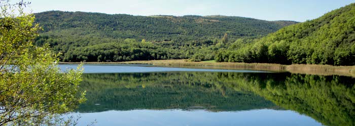
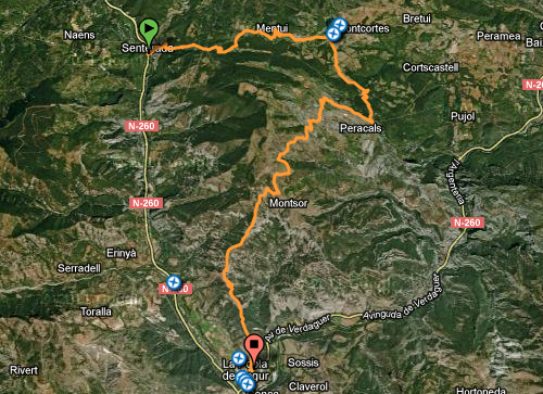
In the final stage, we will exit Senterada in the direction of the campsite and then head towards Puigcerver; however, after a few metres, we will take the old Montcortès path, which passes alongside the Comadars ravine until Mentui. From here, we will continue towards Mentui hill to finally come to the Fifth Lake, Montcortès lake.
We will carry on in the direction of Canals, taking the steps known as Les Escales de Peracalç again, which we will have already taken on the first leg of the hike, and continue along the old Peracalç path to Montsor, which runs much higher above the Peracalç farmhouse.
From Montsor, we have two options to return to La Pobla de Segur:
- Over the Gelat crest, which is only suitable for expert hikers that do not suffer from vertigo.
- Over the old Montsor path to La Pobla de Segur, which descends the section that was ascended on the first leg.
Starting – end point: Senterada – la Pobla de Segur
Points of passage: Senterada – Mentui – les Escales de Peracalç- Montsó- la Pobla de Segur
Accommodation in Casa Churchill
Distance: 23 km
Elevation: +1.461 m / -1.683 m
Maximum altitude: 1.345 m
Minimum altitude: 520 m
Time: 6 h 40 min
Difficulty: The path on the Gelat crest is not suitable for all kinds of hikers. Hikers must be warned to proceed with care to avoid dangerous situations on account of the two sections equipped with ladders and chains as well as the state of the terrain.
Between Montsor and Pobla de Segur you can choose between two routes depending on your level of fitness and experience as a hiker.


Getting to your accommodation
Description
Once in La Pobla de Segur, there will be a transfer service to get to the last lodging house, which is a few kilometres away. However, if we still have some energy left, we can head towards El Pont de Claverol and ascend the old path towards Claverol.
Technical specifications
Starting – end point: La Pobla de Segur – Pont de Claverol
Accommodation a Casa Churchill
Distance: 2,9 km
Elevation: +264 m / -43,2 m
Maximum altitude: 750m
Minimum altitude: 510 m
Time: 1 h
Difficulty: This section does not present any technical difficulty.
Wikiloc
Perfil del recorregut


